Tulcan – Reserva El Angel – El Rosal – San Geronimo – Buenos Aires – Pucalpa – Cotacachi
Having ridden with Cass in Colombia over the tough (and prohibited!) pass of Volcano Ruiz, I was familiar with his kind of riding. So it was a delight to have the opportunity to test ride an early version of the Trans Ecuador Mountain Bike Route (TEMBR) which he has been developing with the Ecuadorian Dammer brothers. The route weaves together a series of backcountry, low traffic dirt roads through Ecuador’s volcanic corridor by which to cross the entire country.
Update: the main official report of the TEMBR at bikepacking.com has now arrived. Here you will find the GPX and a rather more elegant description of the route compiled by Cass.
On a natural high with my burnt peeling nose, I am sitting in my hotel room in Cotacachi reflecting on the last few days. Even though I knew it wasn’t going to be easy it was a lot tougher than I expected! It does however rightly earn a place near the top of my epic mountain bike routes ‘hall of fame’ and has given me extremely high expectations for the rest of South America.
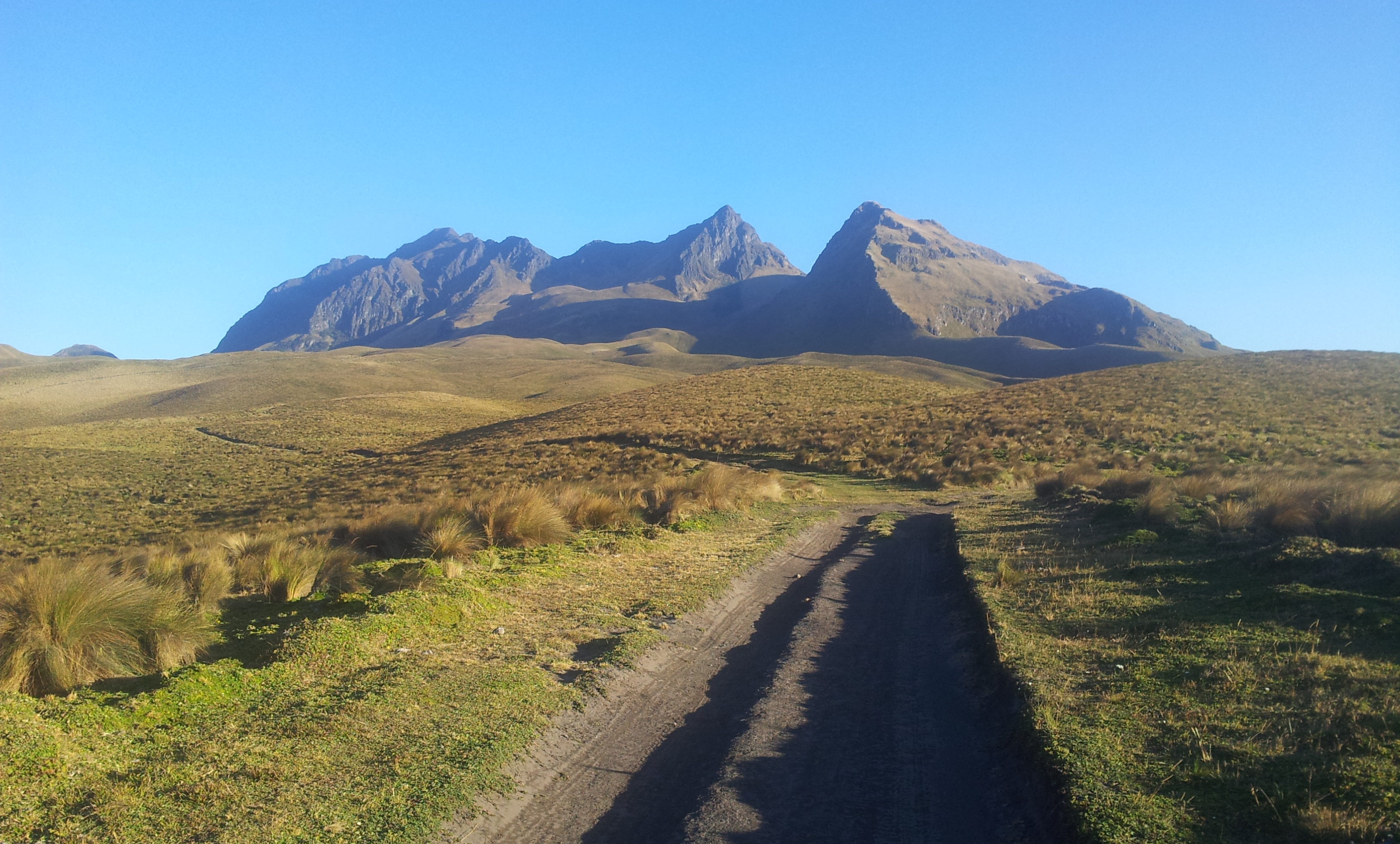
The variety of this first section is undeniable: hot sweaty roller coaster riding in deep winding canyons surrounded by vast prominent mountains at 1000 metres to stunning barren chilly paramos and striking panoramas at nearly 4000 metres. The change of environment brings with it a mix of inhabitants from different cultural and ethnic backgrounds that offer an unexpected and interesting perspective. It is at times both humbling and mind blowing to be in such an unfamiliar, diverse and impressive environment; a real smorgasbord of different new experiences for the mind to feast on emotionally and physically.
Choosing a five or six day high mountain route that could simply be made in two days by following the main road could seem a little illogical to some but to me it made perfect sense (most of the time).

The first night was spent in Reserva Ecológica El Ángel. Along with free entry into the park, I was given a bed (& breakfast!) for the night. Differences were already notable, in Colombia a 37,000 peso charge is often standard in their National Parks; here in Ecuador – nothing.
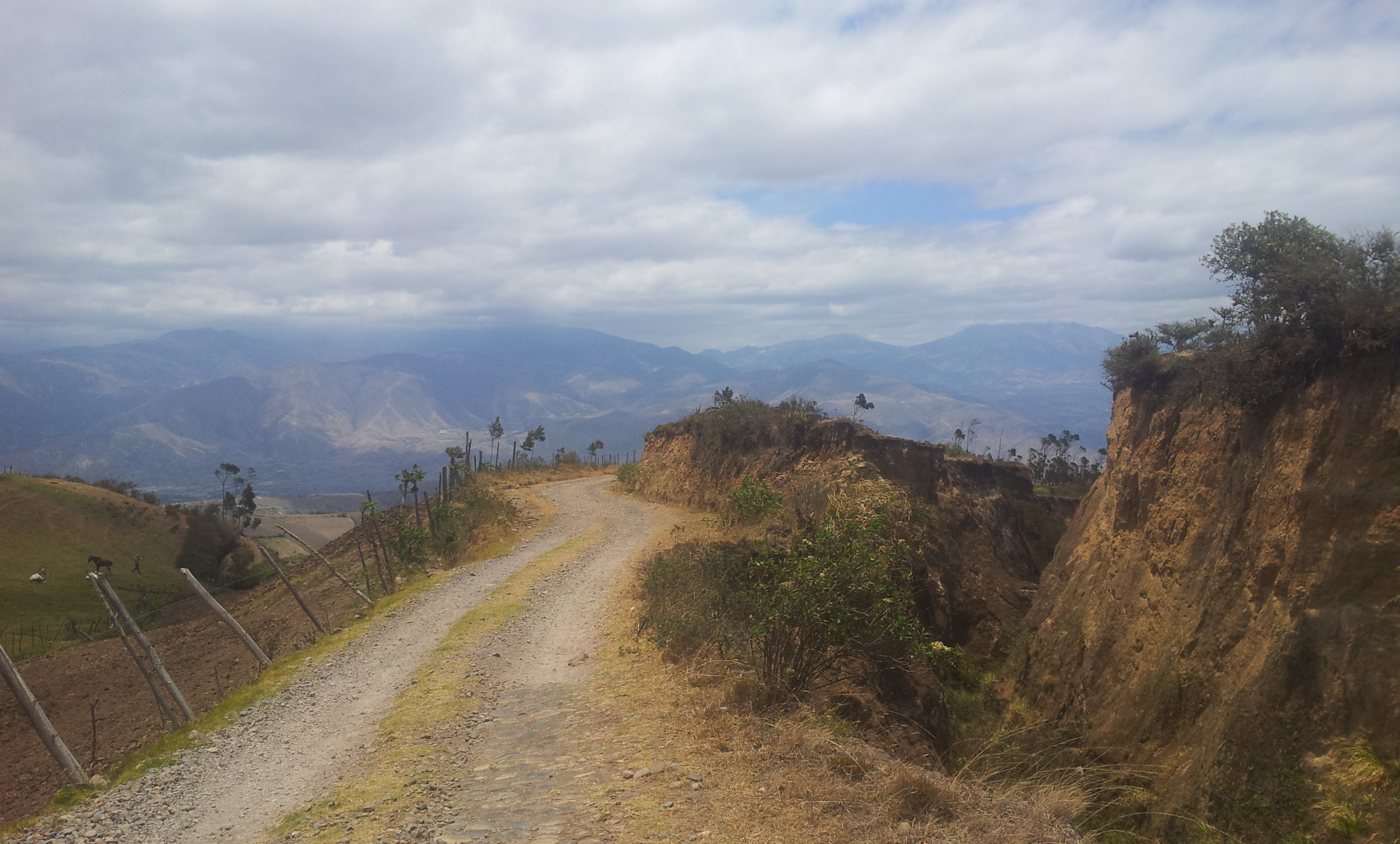
I sought a backroad alternative from the paved section to Mira and found a pleasant route that climbed up past Ecuadorian farmland, dropped down an awesome grassy dirt track and continued along a cobbled descent via Hato and Piquer. Finally, it spat me out on the paved road just above Juan Montalvo. Finding the route took a bit of work, a night in a farm and some extra hill climbing; information was hard to come by.
An short alternative route can be found from Juan Montalvo to Santa Ana . I was told that it involves bike carrying for half an hour along a dangerous rocky path followed by a jagged ridge traverse with steep drops. Although tempted, the midday heat convinced me otherwise…
Whilst dropping all the way on paved from Juan Montalvo to La Concepcion through various towns, I found there to be a notable change in the ethnic background of inhabitants. Virtually all seemed to be of African origin and equally as friendly as their higher mountain dwelling counterparts. All reports from locals were the same – this was a safe route from a security perspective.
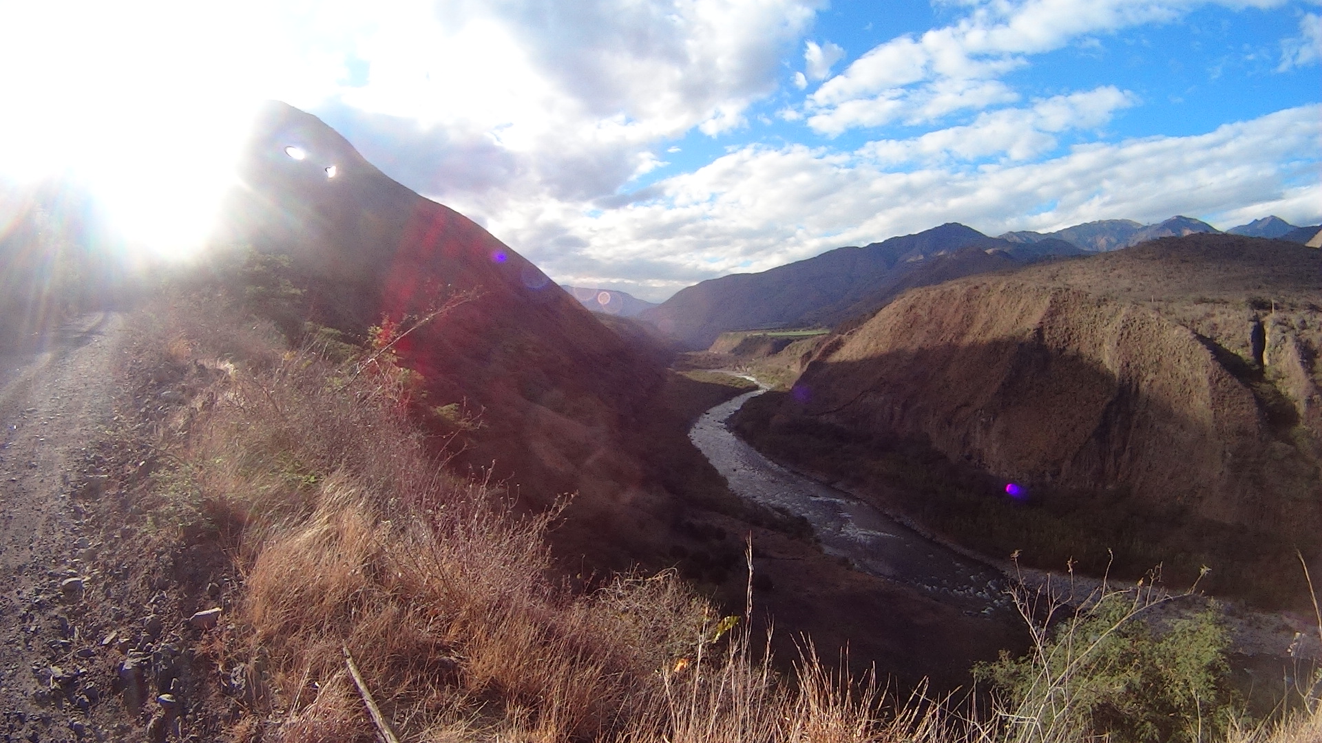
After a night spent camped with limited privacy under the shelter of a public building in El Rosal, I followed the road down to the water.

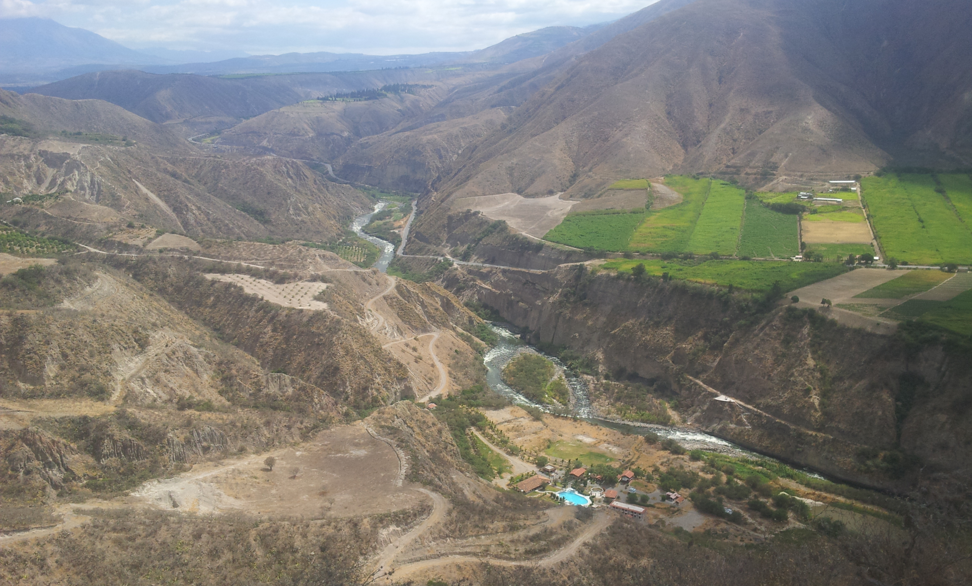
Once down at the river, the path picks up an interesting old railway line that runs parallel to the ‘Panamericana’ on the other side of the valley.


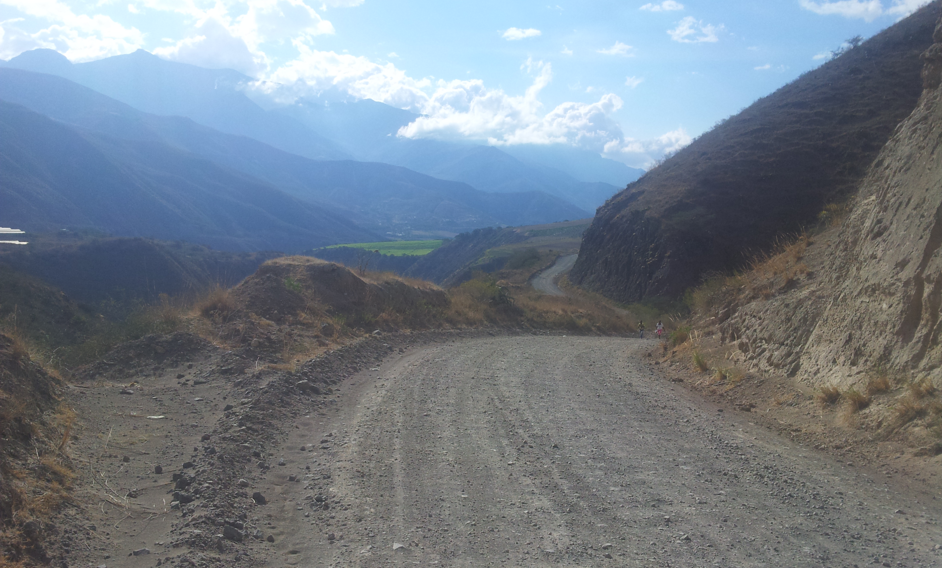
After a second breakfast in San Geronimo I found myself at the start of the mother of all climbs. A monster elevation change of nearly 3000 metres (from 1000m to 3900m). The heat at the lower level proved challenging on the shadeless dusty road.

Approaching the mid way point after a full day in the saddle.

After a night spent at Buenos Aires (the halfway point and last supplies until just before Cotacachi), the road continued steeply upwards with an occasional short downhill. It became much rougher and steeper just before the paramo.
“Was it ok to drink the water?” I asked a passing farmer on his horse. “There’s a drought but yes it’s clean and safe to drink”. I had an upset tummy for the next 12 hours… In spite of this it was hard not to be blown away (literally and metaphorically) by the barren, windy environment. I chose one of the few areas with (limited) shelter from the wind to recover for the night.

Day 6: ready for the final remaining climb to the top.

Looking back at the route I’d taken.

And forward… Reaching the top and the final sections of uphill.
After cresting the top of the pass and plummeting back down 1000 metres, Otavalo felt tantalisingly close. It wasn’t however and the steep ‘foothills’ continued to roll. I took a wrong turn and managed to lose 100 metres of altitude before realising my error; an undoubtedly tough moment. Not long after I made a second wrong turn. I was done, the decision was made to stop. Exhausted and low on supplies, I backtracked up the steep cobbled road to find a place to rest and the first (small) shop since Buenos Aires…

My hosts in Pucalpa. They didn’t ask but I left $10, they had rescued my weary soul and I was extremely grateful. Although sometimes it’s hard to know if leaving money is the right thing to do.
After some (most likely misguided) advice to avoid Marlon I took an alternate route into Imantag that involved a long cobbled descent and a short hot paved climb plagued by small biting flies. With no money or food, things started looking a little bleak until, out of the blue, a Jehova’s witness saved me with $5. Was this karma for leaving money with my previous night’s hosts? I (very) briefly considered the existence of God before heading on to Cotacachi.

Burnt, tired but happy to be in Cotacachi finally. An epic ride.
Route:
Check out the main official report of the TEMBR at bikepacking.com for GPXs and a rather more elegant description of the route compiled by Cass.


Hi Nicholas, I continue to enjoy every description and photo of your blog. I am awed by how brave you are sleeping in the middle of nowhere- enjoy the photos of your tent and bike on your stops. The plank bridge made me nervous. Spectacular scenery- absolutely stunning and what a lucky guy to experience it first hand thanks to your grit and determination- you never cease to amaze me. Glad you stopped in Punta Perula and I now enjoy seeing the world through your eyes. By the way the eye of Hurricane Patricia hit the coast on Chamela Bay where Perula is. Terrible damage in the area already so poor compared to other parts of Mexico. I am now in Cancun having left Canada Oct 31 with RV and 4 cats. Will visit pyramids and natural sites I have not seen before and make my way to Palenque, Oaxaca and slowly back to Perula. May the wind be at your back….. Adele
Thanks Adele, good to hear from you. That’s sad to hear about Perula.
Hope you enjoy your trip through Mexico
Sent from Samsung Mobile
Hi Nick,
Really enjoying the words and pictures on the blog. Can’t wait to see the videos. Best of luck with the cruise and the next biking stage. Best, David and Grace
Thanks Ashby! finally back on the mainland…
Nice bro. Glad to see some previews!
Yep, you’re in for a treat! Just on the last couple of days of the TEMBR now…
Hi Nick,
I hope that you are having fun and making good progress on your adventure. I really like reading your posts!
I am in the middle of preparing my routes for my 1 month stay in Ecuador with plenty of bikepacking. I really love this leg of your trip (the landscape is amazing), but having had a good look at the elevation profile, I have to admit it looks a bit scary 🙂 I am still debating whether I am fit enough to do the route: my heart says go for it, my head urges me to overestimate my capabilities 🙂 The trip is in June, so I still have time to get the legs needed for these types of climbs.
One question I have. How easy was to get water/food along the way for this part of your route (Tulcan to Otavalo)? How much water did you carry, and how often were you able to re-supply water/food?
I read in one of your other posts that you found it easy to find water in the Andes, but this part of the route looks very dry. Also, there don’t seem to be many villages close to the route to re-supply food.
I just want to make sure I don’t underestimate the challenges regarding food/water, and potentially run into a dangerous situation of running out of food/water.
Many thanks for your feedback and help, and wishing you a safe journey!
-Peter
Hi Peter! Just stumbled across this comment, I don’t remember if I ever answered it. The official report is now up at: http://www.bikepacking.com/routes/trans-ecuador-dirt-road/
I imagine you may have already done this but just in case…
I think the longest stretch with no food supplies is between Buenos Aires (halfway up monster climb) and Pucalpa (small shop an hour or so before Cotacachi). Between these two towns I saw no places to get food. It’s two full days in total. (there could be food options f you detour to Piñan). You’ll be able to get water at least everyday and probably more often, I forget exactly how much. However I recommend treating it even on the paramo (lots of cows up there).
Cheers,
Nicholas
Hi Nick,
Many thanks for your replay. I did the trip in June 2017 and it was magical! The climb to Pinan was tough, but magical!
Muchas Gracias for all the information that you provided – it was incredible helpful!!!!