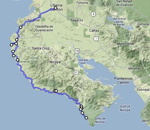
As mentioned in the previous post, Costa Rica offers excellent back road alternatives that avoid the hell-ish Panamerican Highway. The Nicoya Peninsular is no exception. Although the altitude probably doesn´t exceed 250 metres (if you follow the coastal road), the steep short inclines in the 30+ C degree heat are enough to challenge the fittest of cyclists with some sections so steep they are only just makeable without pausing for breath.

A lot of the road is well maintained…
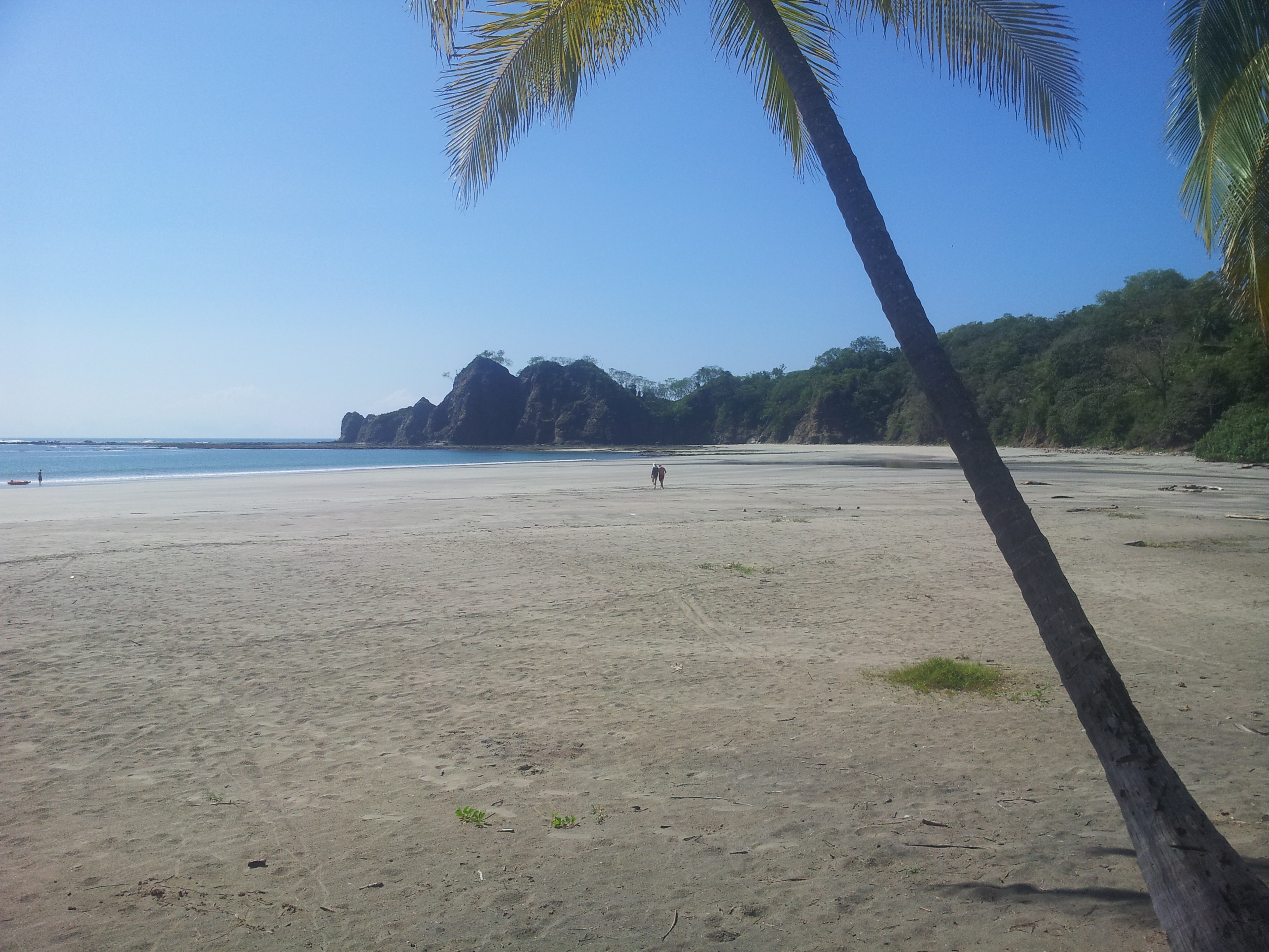
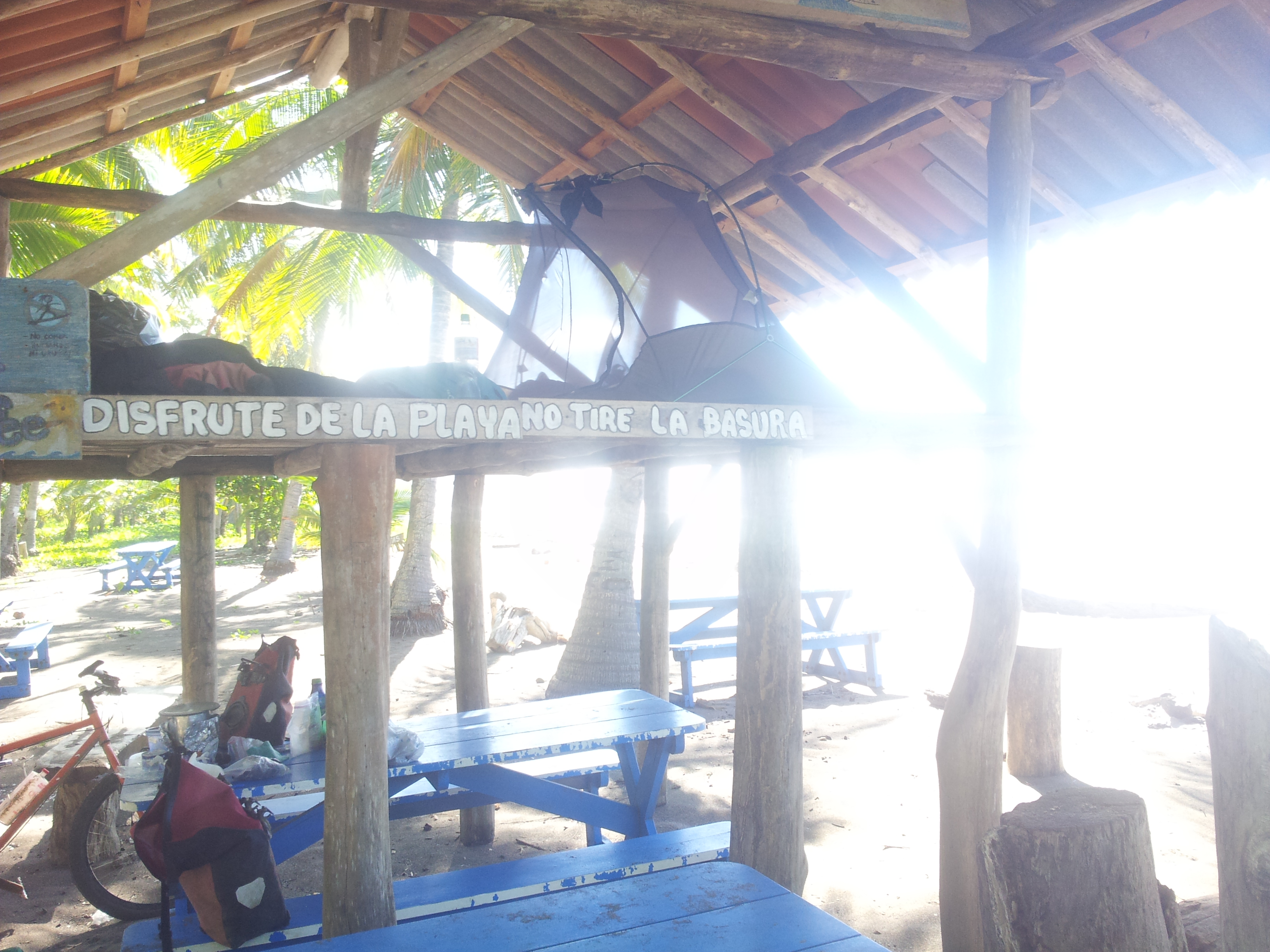
An additional bonus that you can take advantage of is that, in Costa Rica, anywhere 50 metres from the high tide mark is public property. This means two things to me. Firstly, since construction is generally prohibited in this zone, virtually the entire cococnut-fringed coast looks like untouched wilderness when looking back from the sea. A beautiful site indeed. Secondly, it means that you can pretty much pitch your tent in any of the unlimited beaches. I´m told that even properties that have gardens encroaching on the 50 metre mark are fair game (although this would rarely be necessary since there are so many empty beaches to choose from). This means that camping is free and, incidently, feels pretty safe.
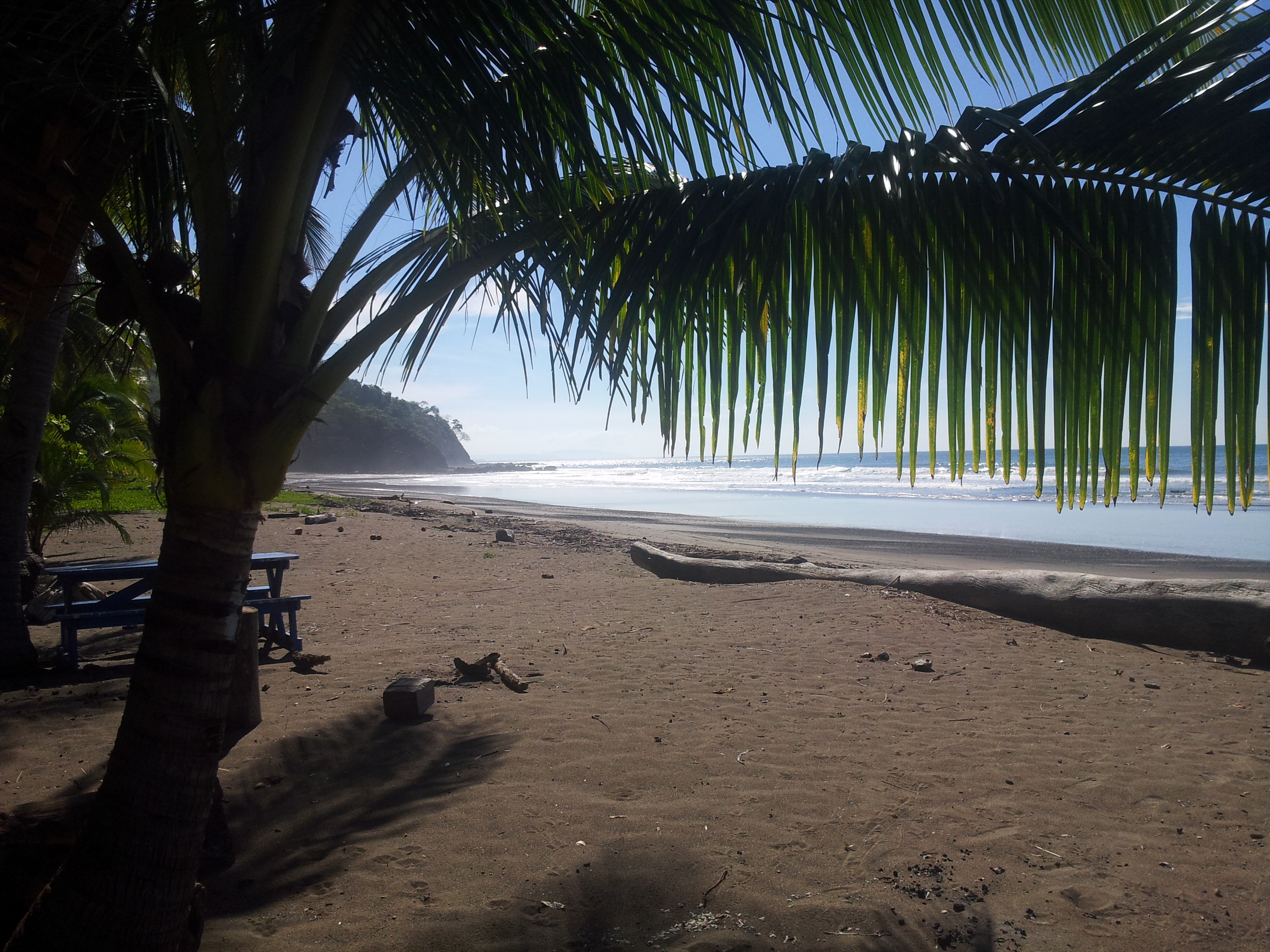
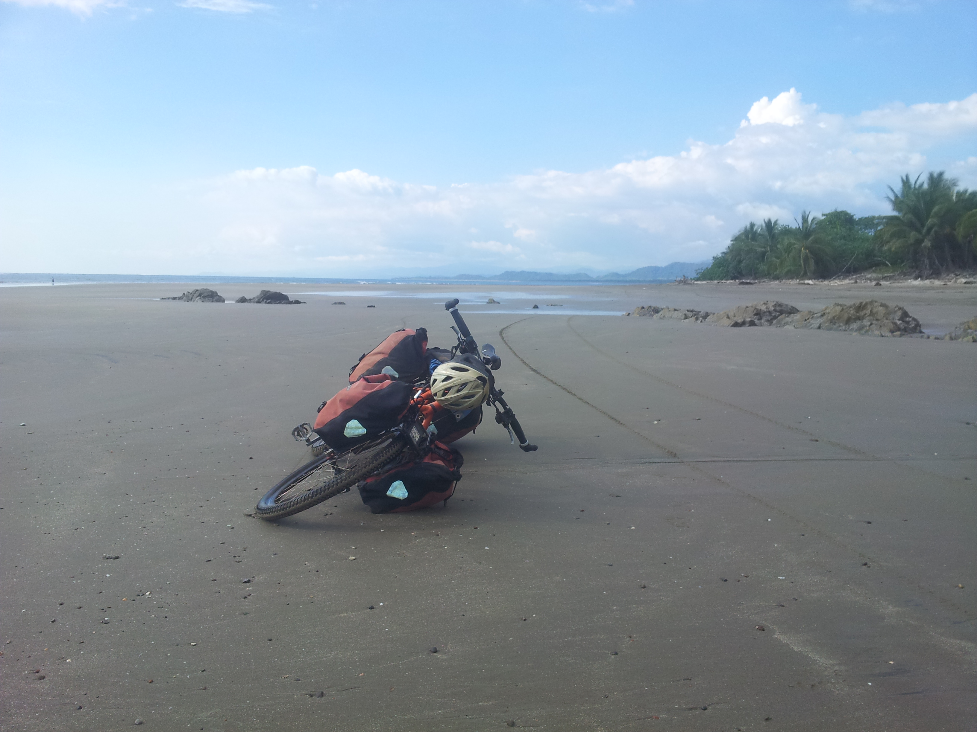
Just south of Playa Sámara
There is no denying that some sections are very touristy resulting in perhaps a less authentic Costa Rican experience at times. In areas like Flamingo and Tamarindo, there is a mild spike in traffic and, for some reason, poor inconsiderate driving; however, further south becomes much quieter since the roads become inaccessible by everything except two wheelers and 4×4 (between Coyote and Santa Teresa). Even at its worst points it´s in a totally different league to the Interamericana. There are also normally options to avoid the main roads in the more northern sections if you´re prepared to burn some fat off on the steep inclines.
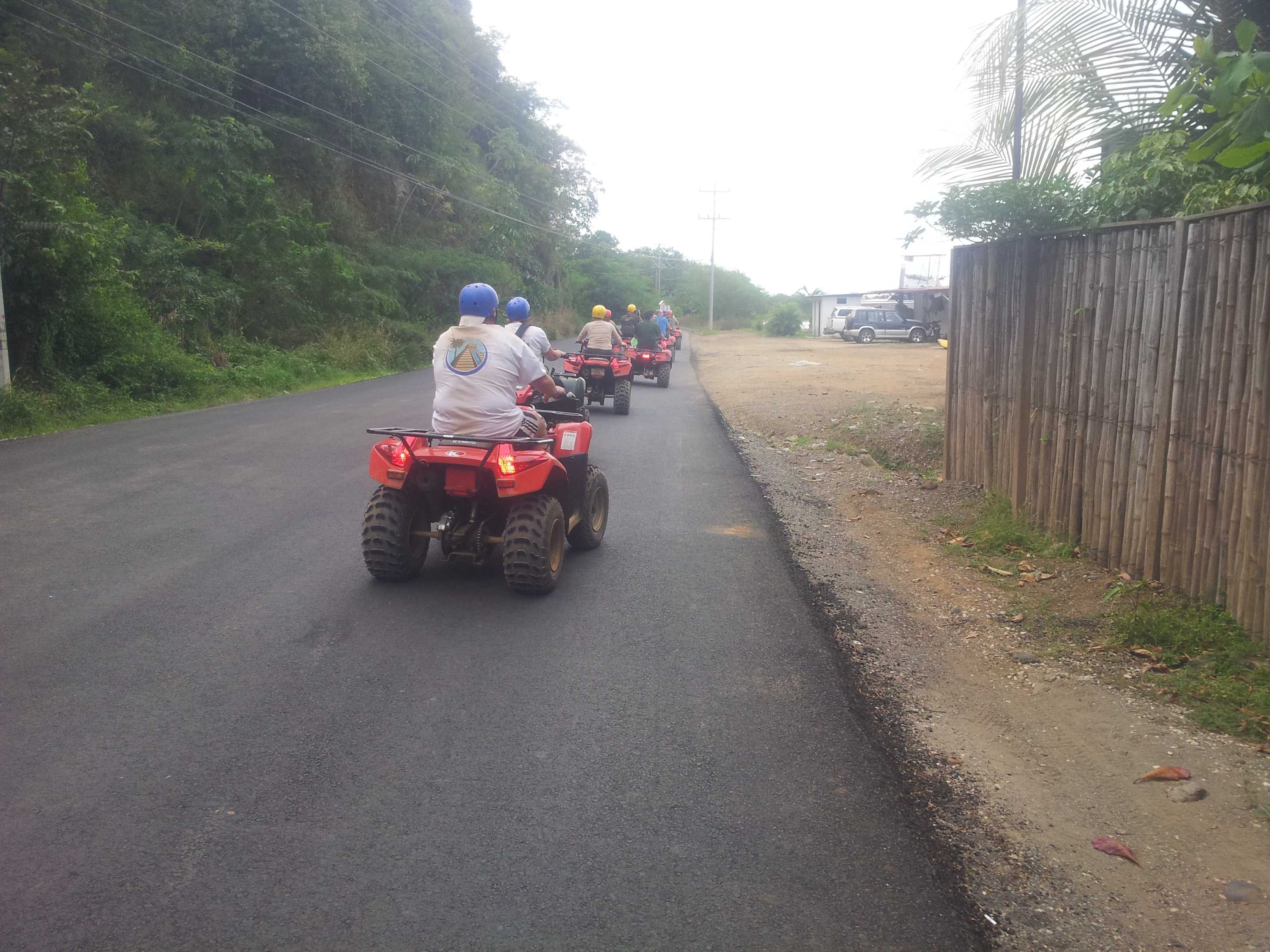
Just after Flamingo we had our first ATV tour pass us. This mode of transport is very prevalent on the Nicoya due to the rough dirt roads (it was paved in the tourist areas like here). I didn´t find them to be an issue, just noisey and mildy tedious…
Again, may I point you to an excellent alternate summary of the Nicoya Peninsular here by the ispirational mountain bike touring specialist Cass Gilbert on his very resourceful blog WhileOutRiding.com who gave me the idea to cycle it in the first place. When I was there I don´t think the dust from the vehicles was as bad as he experienced probably because it was the tail end of raining season.
The main road from Liberia to Guardia is a 20km paved section with a fair amount of traffic and is actually not that pleasant to ride. We found out about an alternate quite route known as the Monkey Trail too late; that would probably be a better alternative and worth a detour.
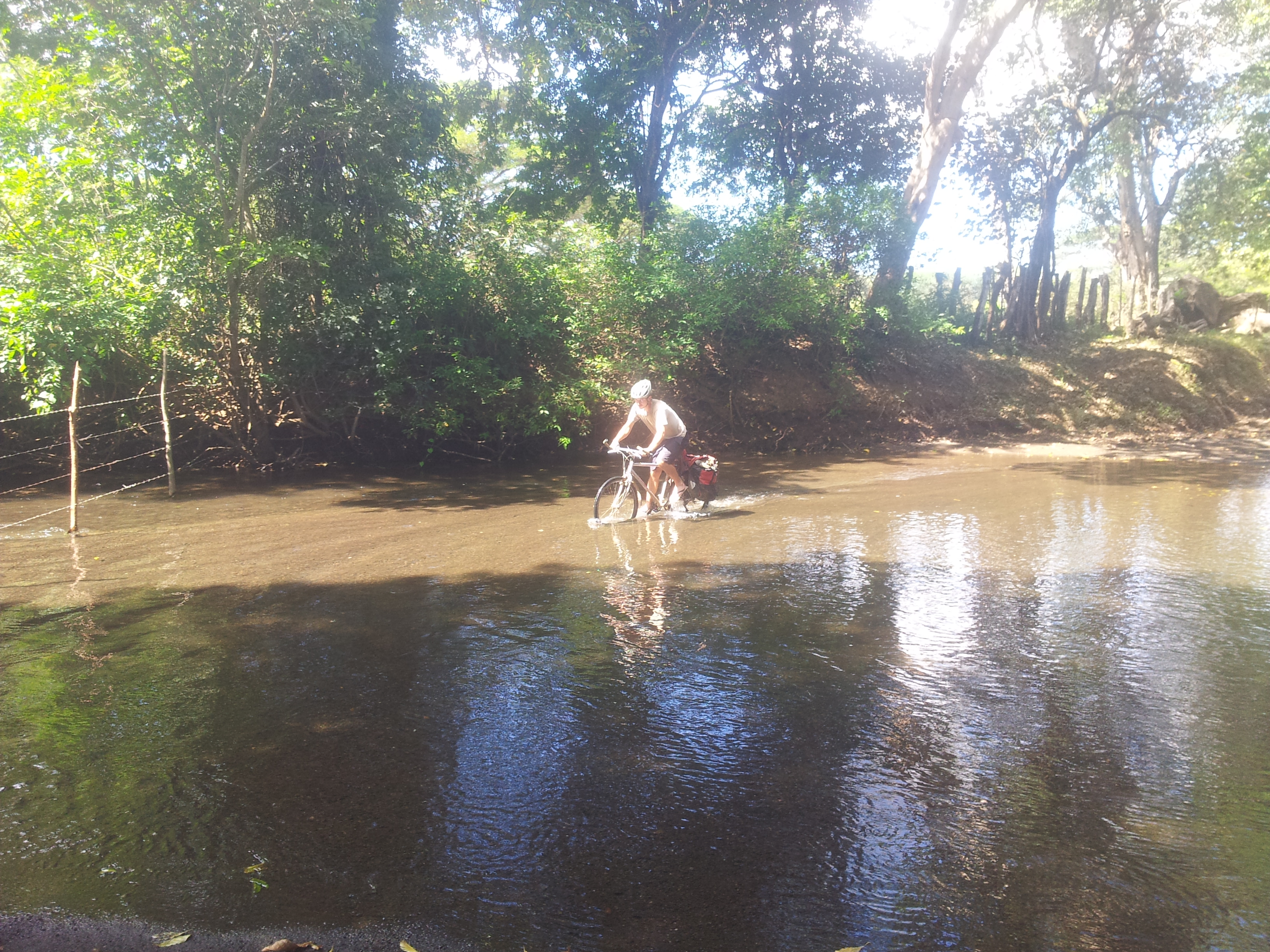
Fjording rivers is an unavoidable part of the Nicoya if you hug the coast all the way round; no more than knee height when I was there. With the soaring temperatures in the midday sun, this clearly has its advantages.

Eric had to head back home from Sámara and cut back country across the Nicoya to get his ferry. Meanwhile I continued down the coast ´suffering´ on these pristine beaches…

Although there is the odd car on the Nicoya, sections like this after Sámara dramatically reduced the traffic to virtually zero in some areas.


Playa Corozalito has a small two-storey hut with a roof under the coconut trees. I nearly by-passed this beach but the locals told me about this hut. Being up on the second floor gets you away from the thousands of hermit crabs that appear at night on this beach. I ended up staying for a few days…
…how could I not?

Breakfast – with the addition of a coconut, provided by the limitless supply of Costa Rican nature…
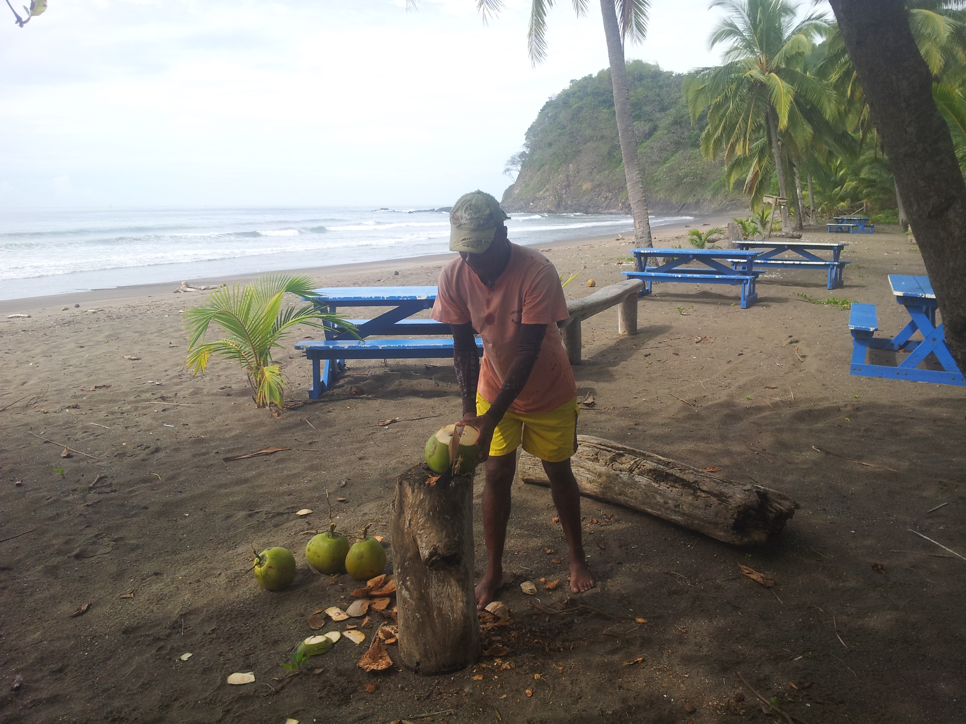
…and the kind local caretaker that looks after the beach…
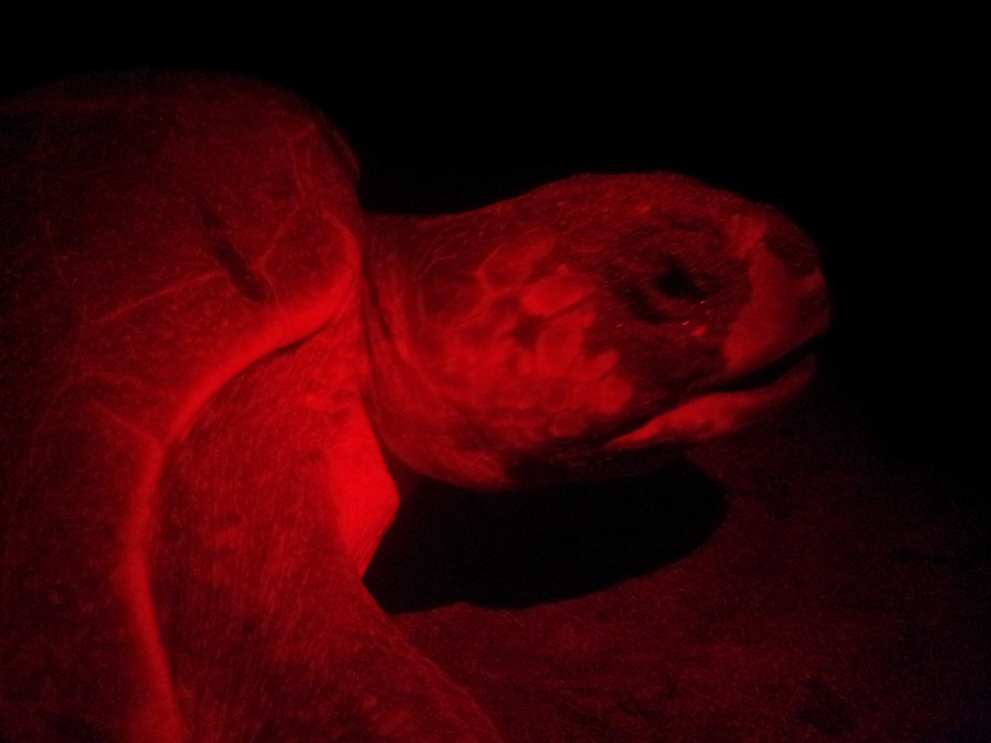
Turtles frequently lay eggs on numerous beaches on the Nicoya; Corozalito was no different. Protection programs are in place for this threatened species. Each night the volunteers from the program would patrol the beach. They alerted me to this adult female laying its eggs at around 10pm for an extensive period; beating the ground and ´crying´ in the process.

Sunrise is normally the time these turtles hatch. They have numerous predators including racoons, coatis, birds, crabs and, worst of all, humans. I woke at 6am to find excited vultures feeding on these hatchlings. I ran over and one of the birds dropped one out of its mouth. Then found these coming out of the sand…
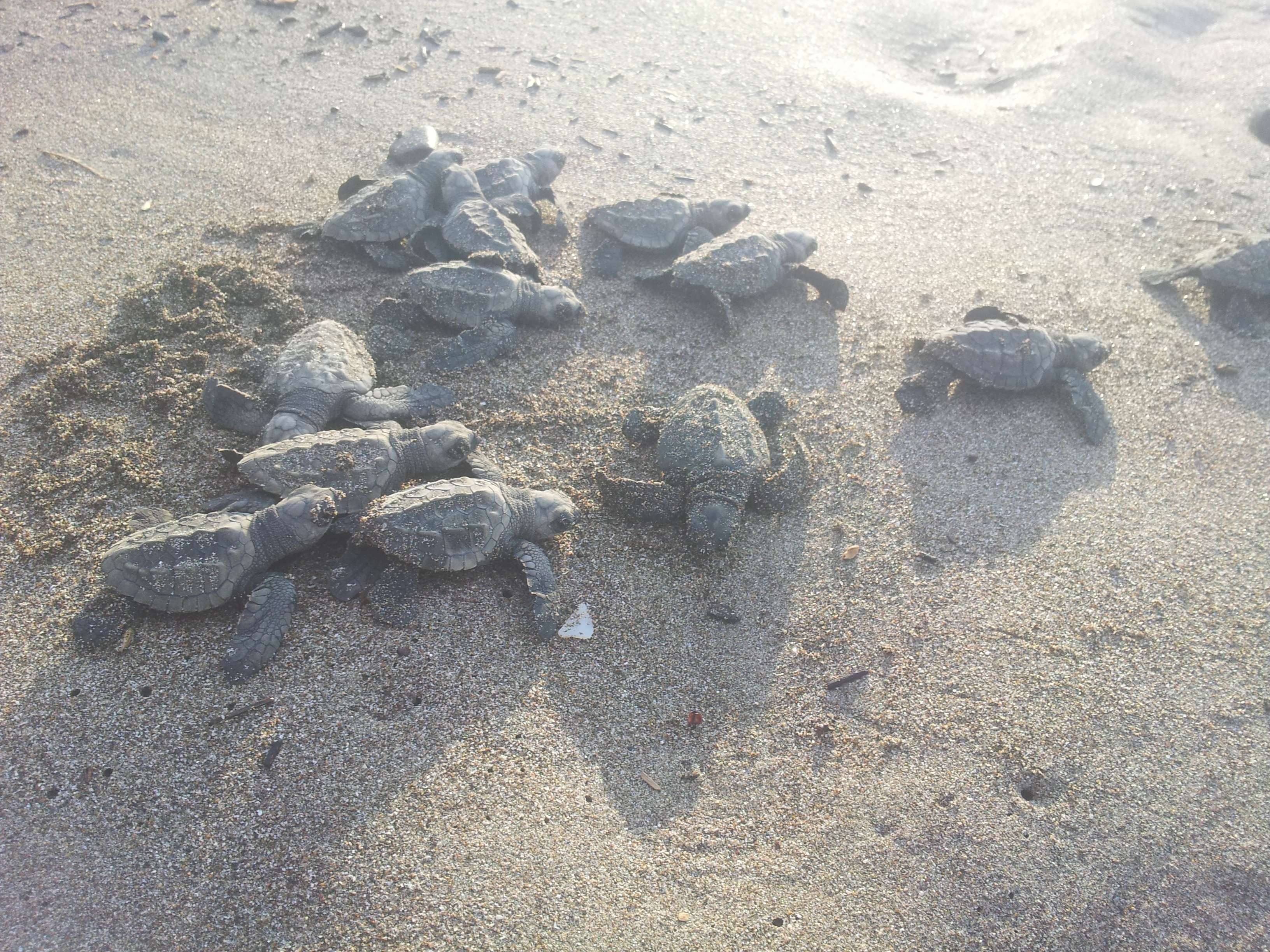
…heading down to the ocean. Around 50 eventually hatched.

One of the patrol girls came to ensure their safe journey to the ocean…

The time came to leave. But only to be distracted 10 km down the road by this beach… Playa San Miguel and Playa Coyote separated by an estuary that´s crossable at low tide. I camped in Miguel´s garden after meeting his kind friend Timothy. Miguel is an Argentinian businessman living in the US who invested in a property at San Miguel. This place remains uncrowded due to the difficulty in getting here. It was great surfing with you guys!

David and Tova also found themselves in San Miguel. They were heading to Santa Teresa by public transport which would have taken all day since you have to cross right over to the other side of the peninsular and back. Another benefit of two-wheeled travel – this route is just a few hours by bicycle. They actually ended up hitching directly along the coast on one of the few 4×4 vehicles that pass that way…
Although it´s not essential, it is possible to ride along the beach at low tide from Rio Bongo to the end of Playa Manzanillo. Since it was possible, I did it…
The road then turns into a nice quite track paralleling the beach to Santa Teresa.

After surfing in Santa Teresa for a couple of days, I headed towards Cabuya stopping at ´Secret beach´ – just continue following the path south after Malpais to get here.

The road to Cabuya consisted of a few short steep climbs before heading back down to the other side…
Hi Nicholas,
I found your blog on google while looking for informations about cycling Nicoya peninsula. I’m currently in the northern costa rican province of Liberia planning my trip. It’s a nice and useful review you’ve done there, thanks ! I could see what I should expect and not. I’ll try to follow the same route from Samara to Montezuma before taking the boat at Paquera to Puntarenas. I’ll make an article also on my blog afterwards. Take care, bye
Awesome thanks bruno. Just sent you an email also.
I picked up La ruta de las Conquistadores about halfway across CR which was awesome (I didn’t know about it until after la fortuna when I passed two other cyclists who informed me about it). You could take it from the pacific coast also as an alternative (the gpx should be linked on one of the posts somewhere later, let me know if they you can’t find them) although I think my route was pretty good too! Too many choices! 🙂
Hi Nicholas,
I’m planning a bike trip to Costa Rica for March 2016. We plan to bring our fatbikes and ride from Tamarindo to Paquera (about 8 days). We’re hoping we can ride beaches and ford most rivers on foot, hopefully find trails across some of the cliff areas. I’ve spent a lot of time around Playa Caletas (I was the turtle coordinator there for 5 months), so I know the area from Coyote to Malpais pretty well, but I’m not too familiar with the beaches north of Coyote. Any recommendations for rivers that we cannot ford, trails instead of roads, cliffs to bypass, etc.? We’re hoping to avoid roads as much as possible, but want to plan for any major detours.
Any recommendations for transportation around the country? I’ve taken buses, but don’t know how a bike would work on the bus. After the Nicoya we’re going to head to the Caribbean for a few mellow days around Cahuita and Manzanillo and are hoping for easy but not terribly expensive transfer between coasts (and from San Jose to the coasts).
Thanks for a great blog!
Sarah
Hi Sarah, thanks for you message. From memory, I mainly rode 4×4 dirt roads except the beach ride; I don’t remember singletrack trails of the top of my head although doesn’t mean they’re not there. When I’m next in front of a computer I’ll dig out my notes to jog my memory a bit (in a few days).
I took two buses with my bike in Costa Rica on the Caribbean side (from the border of Panama to Limon and then back, I think it was). I think it depends on the bus driver and hour full the bus is. The bike was put in the luggage hold below both times. No real problems, may have paid a small fee but nothing major.
More in a few days,
Cheers
Nick
Hi Sarah, You could check my route in the Nicoya on this map to see what is makeable: http://ridewithgps.com/routes/7178211. I would say I was on the main road most of the way but there were some back routes I took. I can’t remember exactly each turn off since it was a while ago; sorry I’d love to help more! If there’s a specific beach you want to know about I may be able to remember specifics.
An option to get across from Pacific to Caribbean is La Ruta de Los Conquistadores. An interesting off road route picked out for a 3 day mountain bike race they have each year. Check my post here: https://nicholasgault.com/2014/08/10/back-post-ruta-de-las-conquistadores-volcan-irazu/
Not sure I’d recommend the final train track section from Siquirres to Limon due to delinquency and massive gaps on the bridge but it was interesting, the post is here for more info: https://nicholasgault.com/2014/08/25/back-post-riding-the-trainline/.
and here:
https://nicholasgault.com/2014/08/15/back-post-costa-rican-caribbean-and-into-panama/
have fun!
Nick
Hi Nicholas;
About to tackle this route in Jan/Feb as part a month long trip to Costa Rica to explore a bunch of the backroads there. Does it matter if you do this from north to south or south to north with respect to wind? Just wondering if there is a predominant wind direction.
Hi Matthew! I don’t remember there being much wind when I cycled it so I didn’t notice if it came from a particular direction. Lots of trees and steep ups and downs which I suspect offer protection from any wind that there might be. It’s a great route, have fun! N
Thanks for the input Nicholas.
Hello Nicholas,
I’m planning to do the same route later this year and was wondering what kind of fuel is available on the Nicoya Peninsula for my stove? Gas canisters, white gas, alcohol, ??
Any advice would be much appreciated.
Thanks,
Charles-Alexandre
Good question – I think I was on gasoline back then using my whisperlite MSR so I wasn’t on the look out for the fuels that you mention. The villages are quite small but you could be lucky. Maybe in the bigger places like Tamarindo you might find what you need. Sorry not to be of more help. Have a good trip!
Hello Nicholas,
My name is Michelangelo, from Italy and I am cyclotouring too, with my wife Federica and recently also with our son Tito, who is 18 months now and is travelling in a Thule Chariot CX. We have already travelled with him to Vietnam twice and to Mauritius.
Next trii will be to Costarica. We’re leaving on Aug 4th for about 16 days available for cycling.
We’re making plans and a very interesting option seems the Nicoya peninsula; after reaching Liberia, we should come back to Alajuela via Arenal Lake. That would be a ~650km loop which is in line with what we did both times in Vietnam.
We’re a little bit worried about the road conditions for the Nicoya part. I have looked carefully the roads on RidewithGPS, but it’s really hard (even with the satellite image) to understand how much % is dirt road and how much paved road, and of course when unpaved it’s impossible to understand how rocky and bad it is. We will still be cycling with Tito on the Chariot CX (he’s 18 months now), and Federica my wife has little experience on dirt road and is using a non suspension cyclocross bike.
What are your comments and suggestion about road conditions for the part you did in Nicoya, and would you suggest a different route than the one you followed? Are there many river crossings? Lots of pushing? Any info about cycling it in August?
In general, for better roads (but with little traffic, no panamericana please!!!) and easier cycling, would you suggest other destinations in CostaRica? We only have 2 weeks and the max total mileage we can afford is 6-700km. In general, climbing, even steep and long climbing is not a problem if the road is paved. A dirt, rocky, unpaved washboard road is more of a problem for us even if flat.
Second, we are a little worried for the budget since we know Costarica is much more expensive than neighbouring countries. How much did you spend on average for cabinas? Have you seen any ‘official’ campsites along the road / on the beaches?
For eating, we will bring our multifuel stove so that we will be able to cook. Is it easy to find supermarkets and shops or is it necessay to travel with extra food?
At last, is there any National Park / reserve that you visited for seeing animals and than you would suggest?
Thanks!
Oh dear really sorry to only just see your message. I’ve was off the blog for a while. I assume I’m too late :-/ how did you get on?
Yes you’re late… but no problem, the trip was great! This was our route for 2 weeks: https://ridewithgps.com/routes/27972992
A little bit too much rain in the first part around Arenal… but it was somehow expected, pity for no volocano views. Unbelievably hard slopes, sometimes I think close to 30% so that we had to push bikes sometimes. My bike with chariot, baby and luggage is well over 50 kilos! 😀
Nice route and well done! Yes I remember it was REALLY steep in parts 🙂 Makes me want to go back! Love Costa Rica…
Hi Nicholas! I’m planning my trip from San Jose to Tamarindo and love your route.
Wanted to ask how is the route from Liberia to Tamarindo (It will add 150 mi or so for me, but I’d do it if you recommended it being nice)
Hi Tanmaya,
Sorry I imagine you’ve done this by now! How was it? If not:
My recollection is rather hazy of that specific section (now nearly 8 years ago which I can hardly believe!). I’m guessing it’s not overly exciting – but if you do it, the 20km “Monkey Trail” section might be worth the detour to avoid the main road. I remember very much enjoying the rest of the route down the Nicoya however.
Cheers,
N