During my time in Guatemala I’ve somehow managed to climb 8 or 9 volcanoes without really meaning to. Each time I have found out about another one it has been hard to resist the temptation…so I think to myself, OK just one more… My obsession started in Quetzaltenango: Volcan Tajumulco (the highest peak in Central America) was the main culprit for my over extended stay here (as well as the excellent and well valued Spanish tuition). I had been about to leave when Tim (a fellow student from El Quetzal school) told me they were going to hike and camp on it with a guiding company. I immediately knew I also had to hike and camp on it.
Initially I was going to do this with the same guiding company since I thought it would be more fun in a big group for once (always normally going solo). They wanted to charge me a late fee and I childishly refused thinking it was unreasonable since I planned to just tag along with them using my own kit and bringing my own food; afterall, what was the difference to them? I wasn’t disappointed by my decision since I was able to choose the best weather for it and go when I wanted; Seraina and I were also able to camp on the summit (impossible with a big group, they have to camp 200m lower and hike up in the dark for the sunrise which I imagine would be fun in its way). There was no-one else on the volcano. Or so we thought… A friendly Guatemalan man surprised us by appearing a couple of hours after sunrise; he’d been sleeping up there on a lower peak without a tent?! It was incredibly windy and cold and I actually suffered a little nausea from the altitude so I was somewhat impressed by his hardiness.
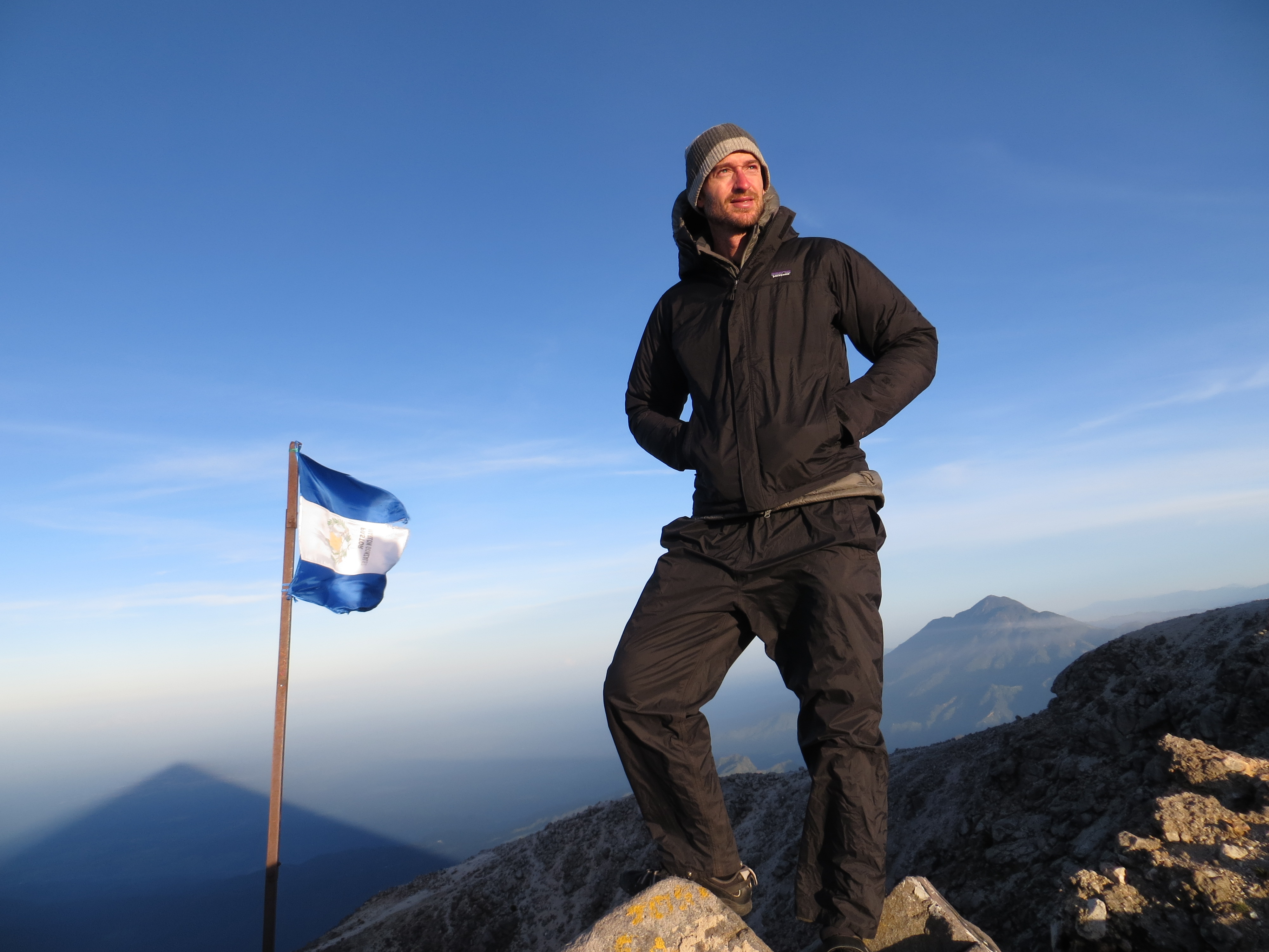
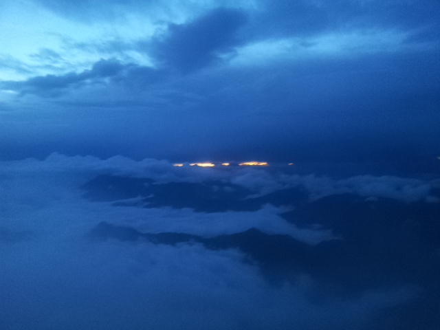
Sunrise summit photo. We camped 2 metres from this spot. Tajumulco shadow on the left and Tacana (second highest peak on the right).
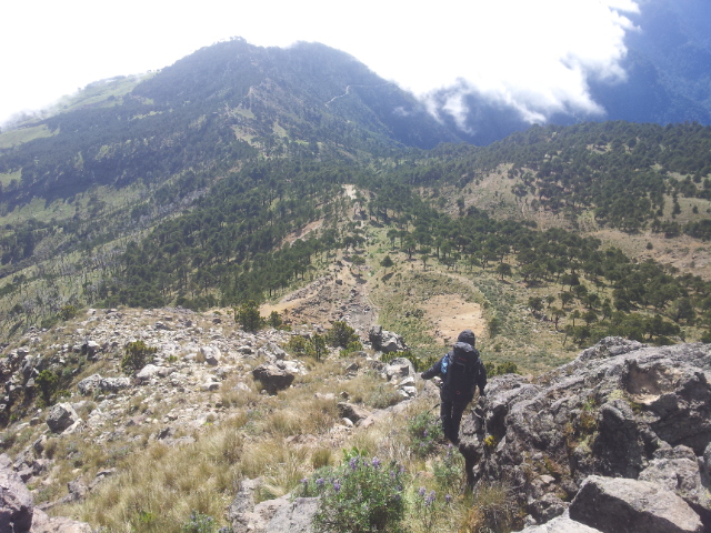
The following photos are in chronological order showing the ascent, camping and then the descent.
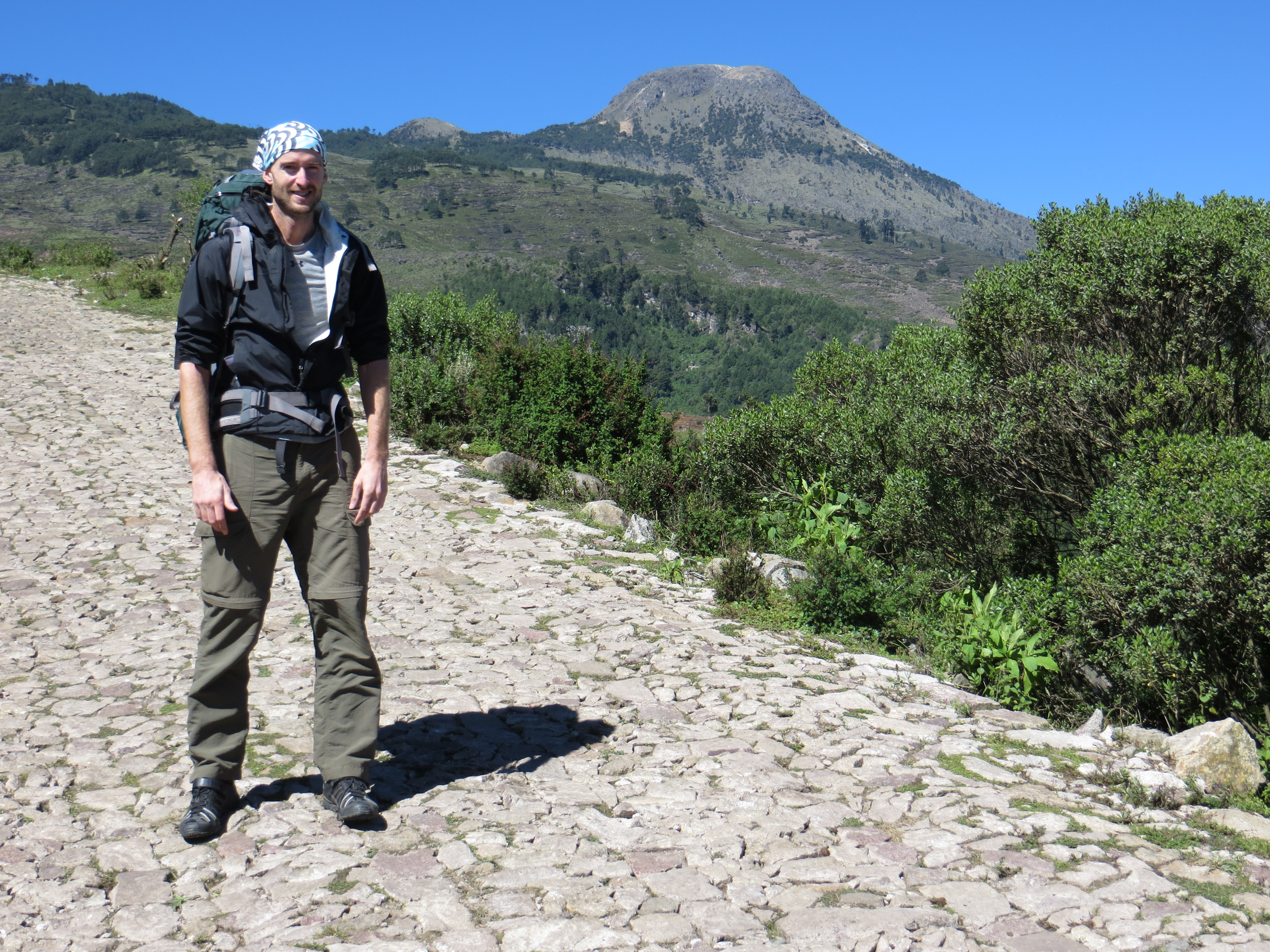
Ready to go at the base. The peak in the background.

The reality is that it’s not a hard climb and many people do it each year. It only took 3 hours to get to the summit with all our gear. There was some navigation but it’s really not that complex if it’s a clear day; the info is all over the web.

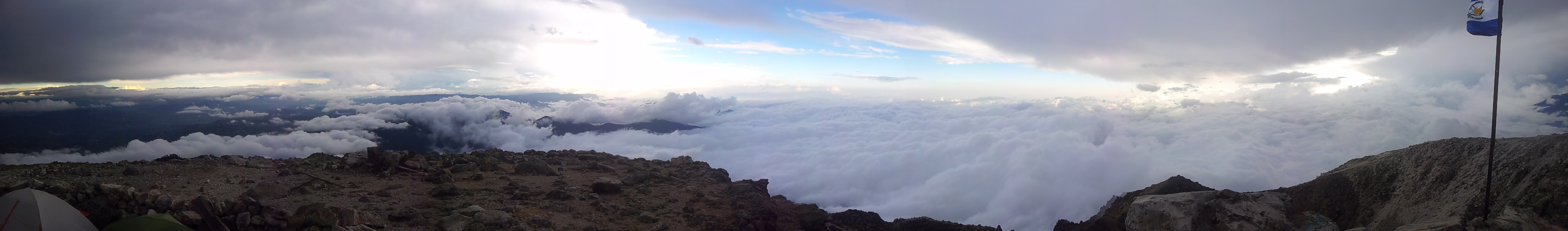
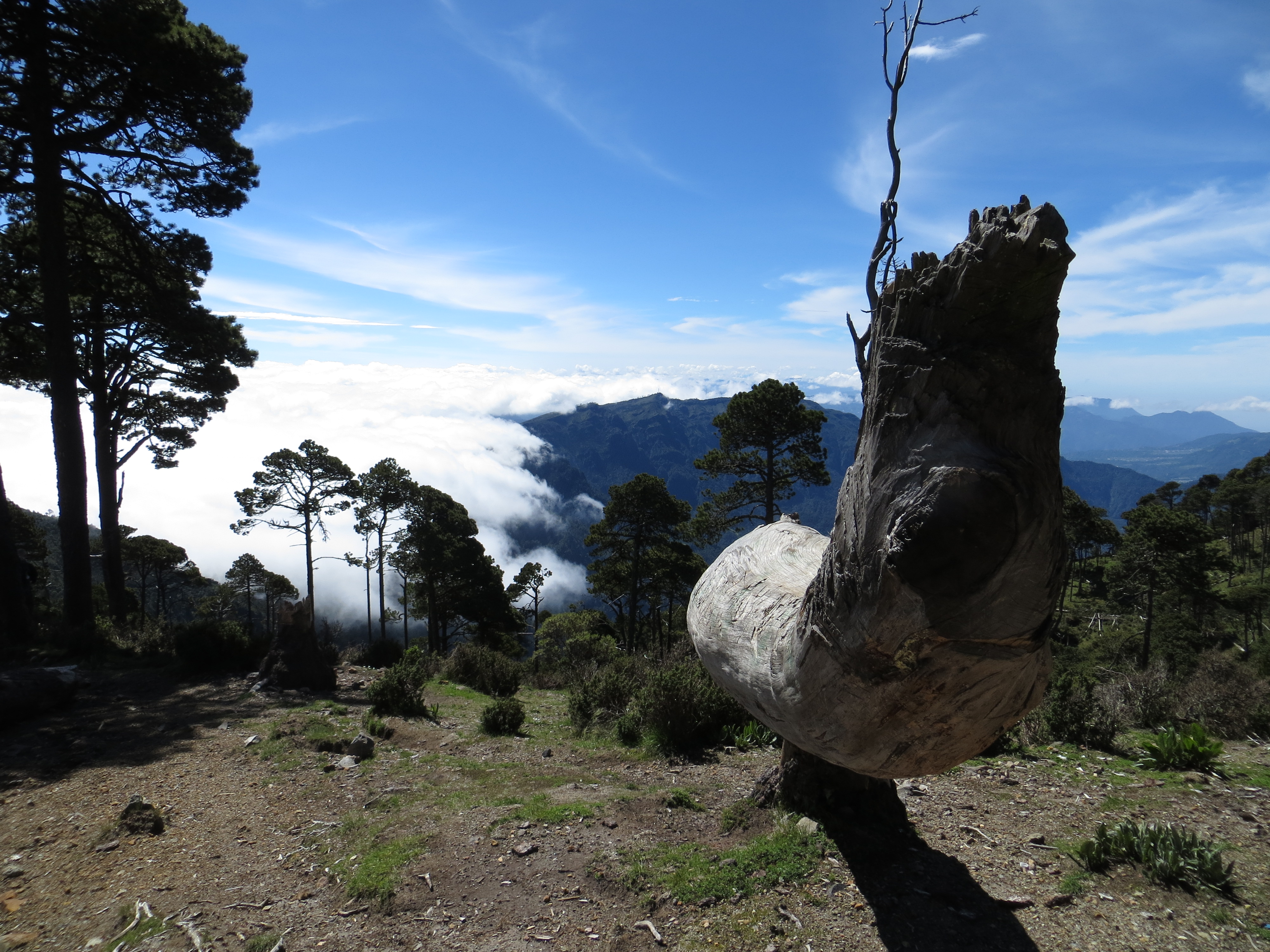
Sunset! Looking towards the second highest peak (Tacana). Since it was so windy the cloud formations would change every 2 minutes giving the appearance of a constantly changing landscape. Due to the immense 360 degree view we had, I tried to savour every moment ignoring the pleas to get inside the tent from my numb fingers.

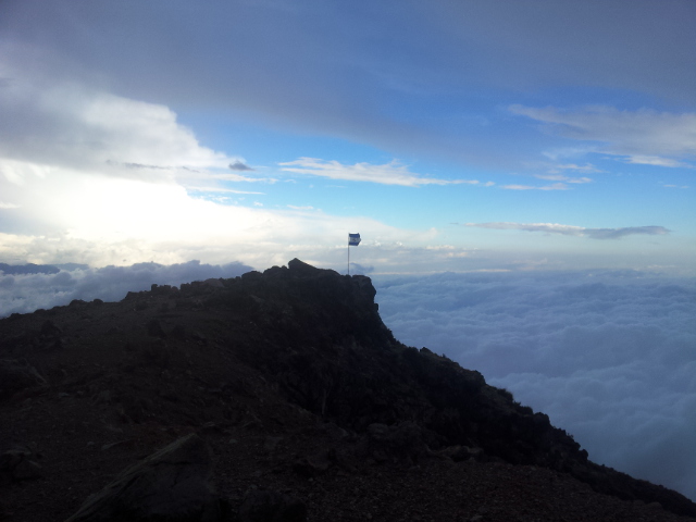
A moment in the clouds. 10 minutes later the view appeared again. But it was SOOOO WINDY! Gloves virtually essential. There was frost on our tent which I assume means it was below zero celsius.
Looking down into the crater


Sunrise – I think that’s me!

Another shot of Tacana, right on the Mexican border.

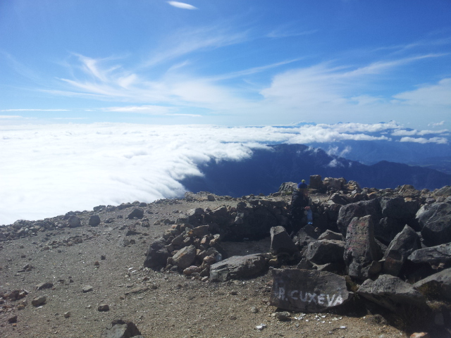
We had a couple of hours of clear views in the morning then a front started coming in at high speed! Time to descend.
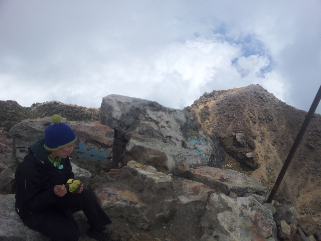
After circuiting and running down into the large crater it was time to pack away the final bits and pieces.


We took a different route down off the summit. It was steep and covered in loose rock, probably the only sketchy part of the hike.
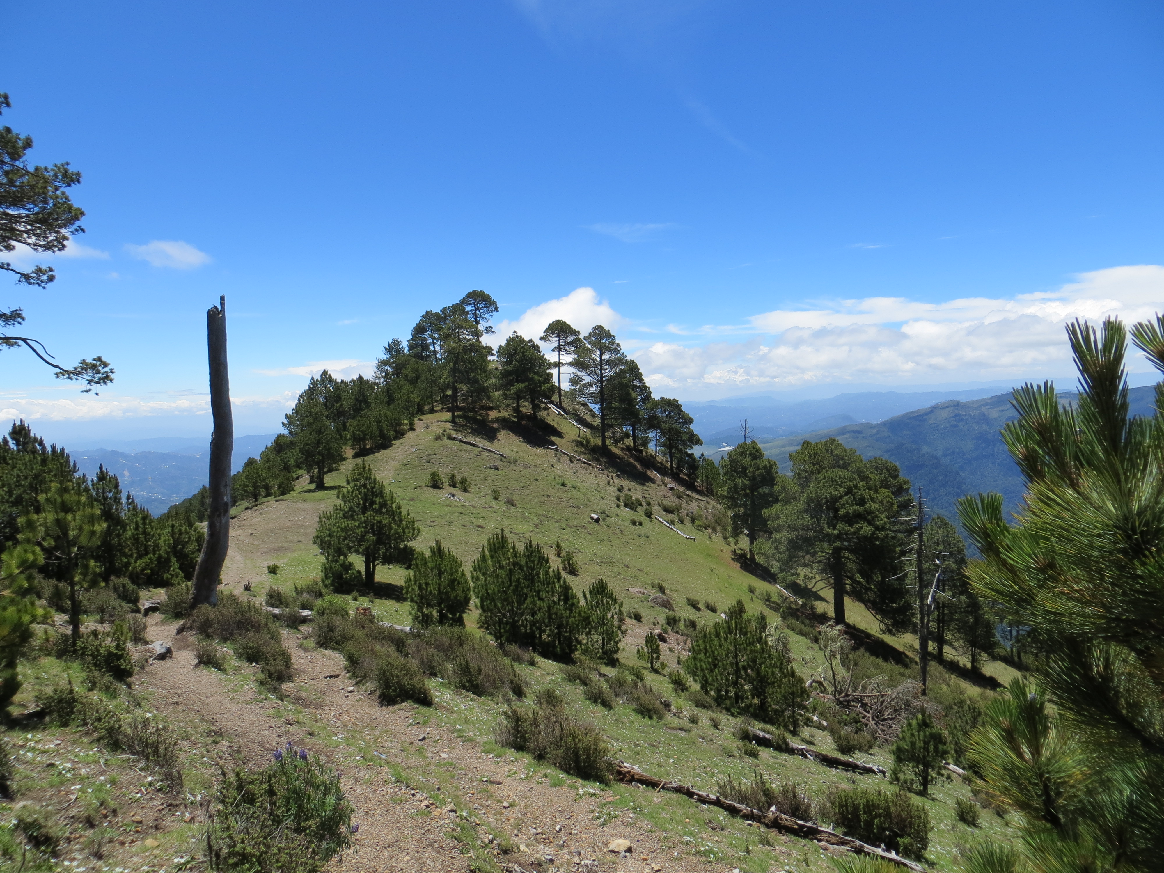
This is where you can go two ways. On the way up we came up from the left and on the way down we followed the ridge.
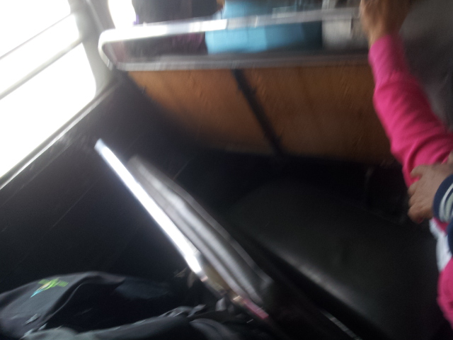
The most dangerous part of the journey was the 2 legged / 3.5 hour chicken bus ride we had to take. This seat had collapsed next to us and both ours and the one in front was bouncing up and down with 3 heavy people sitting on the one in front; zero leg room and both held on by one screw. Each time we went over a road hump I had to stand up, not wanting to break my ankle / leg should either seat collapse. Sitting on the back seats with our heavy packs on our laps, diesel fumes and very loud (bad) music, it was somewhat testing.
The rest of my time in Quetzaltenango

Santiaguito (active multiple times per day; this erupted twice when we were there) – this taken just over and down 50m from the summit of Santa Maria. From this point, we hiked down 300m closer; careful though, there is a GIANT cliff below! After viewing, we picked up a different path back round which hits the orginal main summit path on the other side. This avoids the need to hike back up to the main summit.


Mount Zunil – El Quetzal Spanish school friends (Ellyn, me, Ames, Tim and Seraina – thanks for taking it Jenne!). This peak requires some navigation and it’s not totally straightforward; research online. This was my only rainy summit; we started a little late and missed the weather window but it was a fun hike. A Guatemalan local was conducting a ceremony at the top so we didn’t stay long so as not to disturb him too much. Fortunately Fuentes hot springs sits at the base of this hike (hot water coming off the rocks into man made pools) so it was an excellent opportunity to warm up. Be warned though, the first section from the hot springs is immensely steep and slippery (particularly when wet!); it was interesting coming down this part (mostly on our backsides!).
(I highly recommend the Quetzaltenango school El Quetzal (and Claudia – my teacher – who I wish I could have continued with but I wasn’t quick enough to book due to changing my plans). Book early!
El Quetzal: http://xelawho.com/elquetzal/

From my bedroom window in Quetzaltenango – late morning clouds marching in like clockwork each day

The rooftop of my second school ‘Pop Wuj’ (El Quetzal were booked out on the remaining weeks). Also a very well run school in Quetzaltenango; much bigger. They’re involved in a lot of local community work and have a medical program. We were close to maximum Gringotenango capacity (July is the busy month here) and had a fun group of people (beer pong, LMFAO etc). (Gerson was my excellent good humoured teacher).
The peak is Santa Maria; sometimes Santaguito can be seen erupting from here.
Pop wuj: http://www.pop-wuj.org/
Wow, great pictures Nick. I’m definitely adding that volcano climb to my Guatemala “to do” list. Best, Carl