Tumbaco – Cotopaxi – Chimborazo – Quilatoa – Guamote
Snaking through three classic giant volcanoes, this is an undeniable highlight on the Trans Ecuador and not to be missed. My particular experience involved exhilarating and nervous moments passing through closed Cotopaxi volcano National Park; enduring hailstorms, fording streams and hiking through mud on the north side of Ecuador’s highest peak Chimborazo (which I resolved to return and climb); and following some manmade water channels by a somewhat treacherous drop off (heart in the mouth moments). All part of the norm crossing Ecuador’s mountains.
Update: check out the main official report of the TEMBR at bikepacking.com for a rather more elegant description of the route compiled by Cass. (Complemented by his exceptional photography).
A photo journal of my experience:
In preparation for the tough TEMBR terrain that lies ahead I opt for a tyre upgrade and swap out my old 2.0 inch Maxxis for 2.5 inches. It feels like I have a fat bike…

…but Brian’s 4.8inch Surly “Ice Cream Truck” quickly changes my mind.
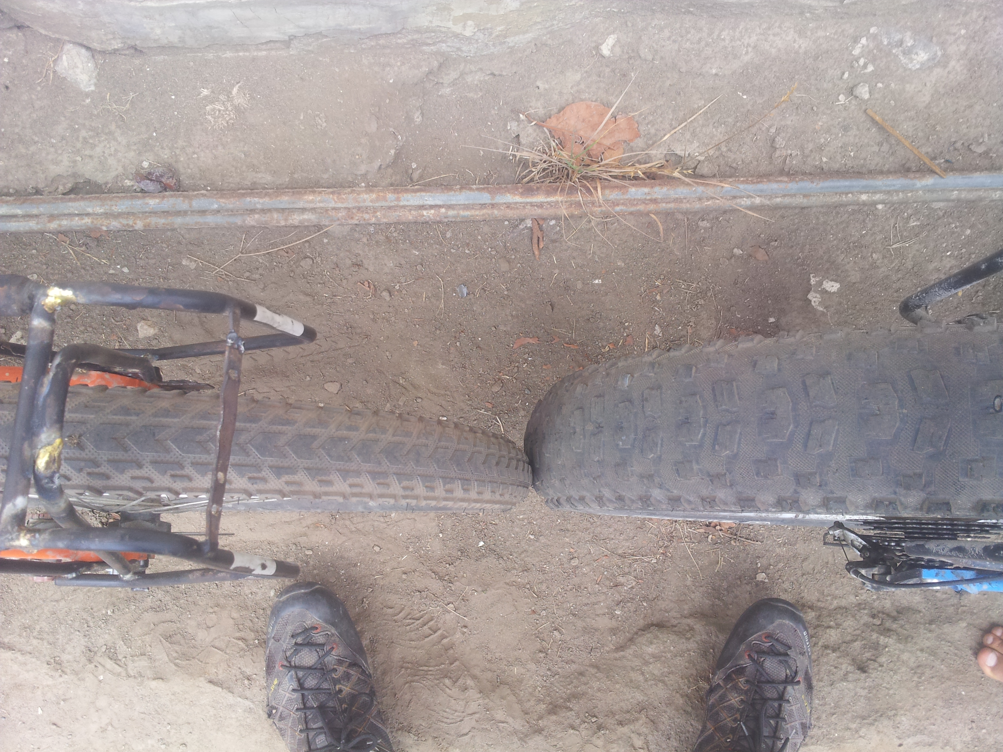
Fat bike envy…putting my wheels in perspective. See video for featured “Fat Bike” ballad.
Managing to pull myself from the comforts of Tumbaco’s casa de ciclista, a quiet hilly route takes me into the jewel of Ecuador’s crown, Cotopaxi. Arguably one of South America’s most lethal volcanoes, it is unfortunately closed due to recent activity. However, I decide to make a run for it. After a slightly uncomfortable run-in with some strange folks high on mushrooms I have a nervous night stealth camping on the fringes of the park. I choose higher ground, a short distance away from the volcano’s main mud and lava flow (almost definitely futile in the event of an actual eruption!) and awake to this…

A rare cloudless Cotopaxi day.
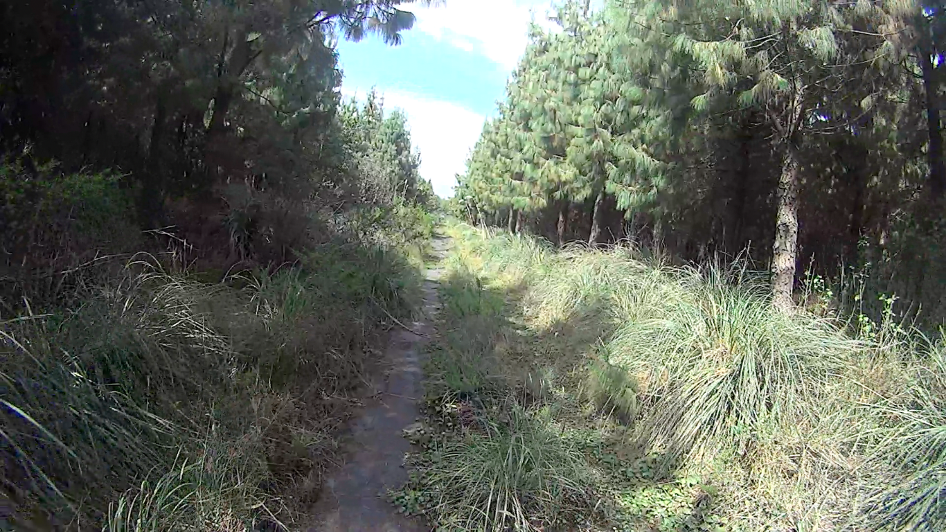
After an adrenaline fuelled dash across the Northwest side of the park, this fun fast single track catapults me to its western outskirts.
To avoid the southern control station I must hop over a couple of locked gates and pass some private property but it feels good to be out of the danger zone. On the climb up to Isinvili I find myself riding in the dark searching for a place to camp. After an unfortunate incident clocking an aggressive dog on the head with a small rock I settle for a hidden spot by a stream and bed down riddled with guilt. The next day a quick return down the road and I am relieved to find the dog alive and barking as aggressively as ever.

Cotopaxi on the horizon. Heading up to go down and then up again on the dirt road towards Isinlivi.
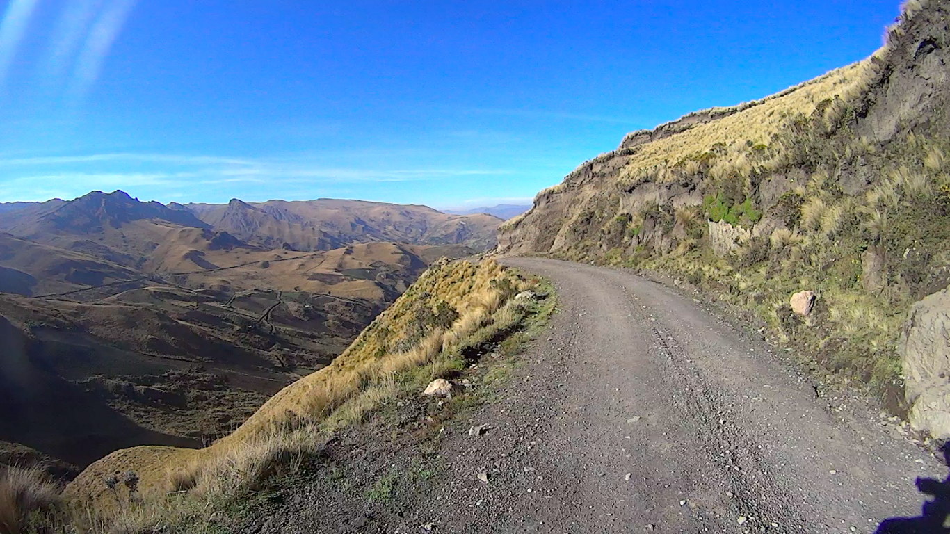
The long scenic descent down to Isinlivi.
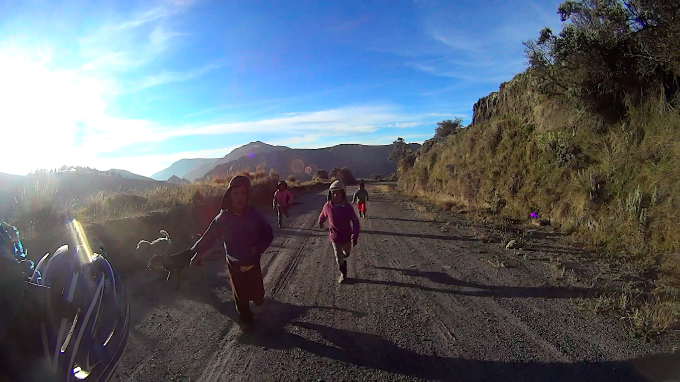
Then up to Quilatoa. These kids chase me for about ten minutes before exhausting themselves.

Quilatoa. An understandably popular attraction with travellers.
I have a very wet night at 4000+m before the start of the climb up to Chimborazo. I am cold and tired and my kit is soaked. The rain makes no hint of relenting causing a notable dip in my morale. To my utter delight I stumble across some hot baths (ok, luke warm but still…). Here I camp under the roof for the night before the climb up to Chimborazo.

Enduring hail, fording streams and hiking through mud on the north side of Chimborazo.
Chimborazo’s northern pass climbs up to 4300m+ and is worth every calorie. After dropping a fair way on a muddy wet trail there is a short section of bike pushing and carrying across vegetation / streams which eventually connects to a gravel road. The trail continues to drop and pass through some interesting features…
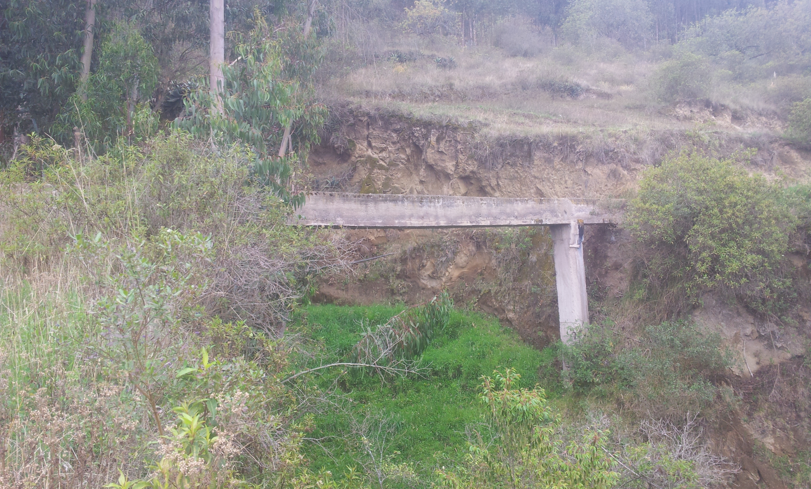
The most notable of which are these manmade water channels.

After witnessing an old señora casually stroll across, I manage to pluck up the courage and cross in three separate loads!
Check out the main official report of the TEMBR at bikepacking.com for a rather more elegant description of the route compiled by Cass. (Complemented by his exceptional photography).
(This was done some months ago and I’m now finally re-united with my laptop.)
Next: The Trans Ecuador continues to Cuenca…


So funny! I rode with Brian from Medellin to Zapatoca! Awesome that you two shared some trail too! Now we just need to close the rope and hang in Peru!
— Scott
Yes that would be awesome! No doubt you’ll catch me up. haha
Hi Nick,
This route looks awesome, but as you suggested I would like to avoid the water channels/bridges. Do you recall where it is best to diverge from the route you took to avoid them?
Many thanks!
-Peter
Hi Peter, thanks! The part you refer to with the water channels is after crossing the North East side of Chimborazo heading South and before Cajabamba. They start about a kilometre after the small town of San Juan. If you zoom in on my route map (http://nicholasgault.com/route-so-far/) using ‘OpenCycleMap’ to where Cajabamba is and then track back from there you’ll find San Juan. You’ll see the route going South-East after San Juan, as soon as it turns South-West the water channels have finished. However it then climbs a VERY steep hill (a pusher) which I guess you could avoid by taking the road. Maybe just take the back roads straight out of San Juan to Cajabamba to avoid wasting time. Let me know if you have other questions. Good luck!! Nick
PS. The North-East side of Chimborazo is awesome but v. muddy when wet, so perhaps pass by on the South West side if it’s forecast to rain. It’s not impossible when wet but quite arduous in sections. There is at least a few hundred metres of hike-a-bike regardless of the conditions.
(If you cycle the South West side, you can also cycle up to the refugio at 4800m. Climbing to the summit of Chimborazo is also an option but at 6300m is quite tough and would require fair bit of preparation in Riobamba (I know some good guides)).
Many thanks for the pointers. It was my impression from your blog/videos that the landscape is awesome, but some parts can be very challenging. It is good to know about the challenges in advance.
Hi Nick,
Many thanks for getting back to me so quickly, and all the information! I probably will have other questions once I had time to look into the route in more details!
Wishing you great travels this week!
-Peter
Hey Nick,
You mention being reunited with your laptop. Did you send your stuff ahead in Ecuador? We’re looking at getting dirty here before we finish this tour, but I’d like to send a bunch of our weight on to Guayaquil where we’ll be flying out. I’m going to look into the bus companies when we’re at the Casa in Tumbaco, but was wondering if you had any insight.
Lewis
This is only to change my email address to actually receive response notifications.
Hi Lewis, looks like I missed this comment! I didn’t send any stuff ahead. I left my laptop in Cuenca and headed off to climb mountains throughout Ecuador and visit the Galapagos. Then returned to Cuenca. Sorry not to be more helpful!
Saludos!
Nicholas
No worries. We ended up meeting someone at a hotel in Cotopaxi who lived in Guayaquil so she took a bunch of our stuff in her car so we didn’t need to take it over the Quilotoa tracks or the really tough route we took to the coast. Turns out flatlands aren’t necessarily easier!